|
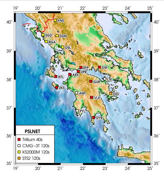
Introduction The University of Patras Seismological Laboratory (UPSL), has a long history in seismicity monitoring in Western Greece, the area with the highest level of seismic activity in Europe. The first network was installed in early 90’s around the city of Patras and it was based on short period sensors with analogue telemetry, (called PATras NETwork, PATNET). This network was monitoring the regions of Patras and western Corinth Gulf for a few years; latter it evolved into a regional network for the entire area of western Greece. Recently the deployment of a new network started. It is called PSLNET (Patras Satellite Link NETwork) and will substitute PATNET (Fig.1). It is based on three component broad band sensors and satellite telemetry. So far eighteen stations have been deployed and the plan is to have a total of twenty six stations by the end of 2009. Real time data are transmitted to central station in Patras University and then stored and processed both automatically and manually. Phase picks, locations and moment tensor solutions are stored in our web page and also sent to EMSC. Recently PSLNET became a part of the newly established Hellenic Unified Seismic Network (HUSN), thus real time broadband data are shared among the four partners, Geodynamic Institute of National Observatory of Athens, Seismological Laboratory of National and Kapodistrian University of Athens, Seismological Laboratory of Aristotle University of Thessaloniki and Seismological Laboratory of the University of Patras. PSLNET and HUSN networks have a strong potential to improve studies of the seismic sources and reveal details of the complicated tectonic regime in Greece.
Figure 1. Map of present PSLNET station distribution.
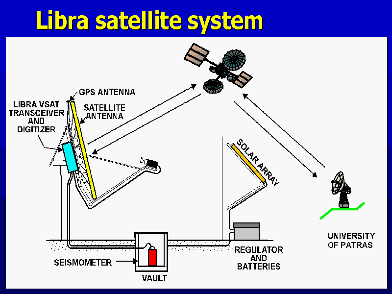
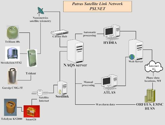
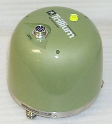
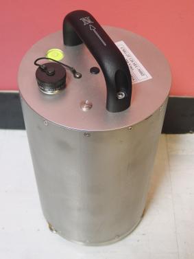
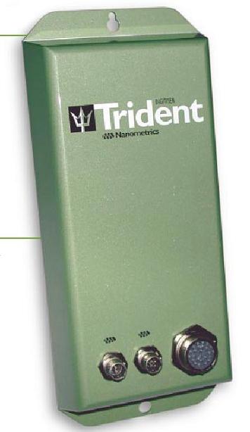
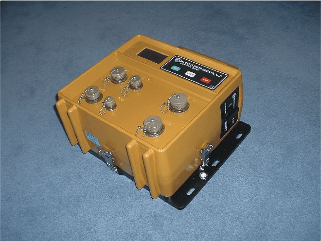
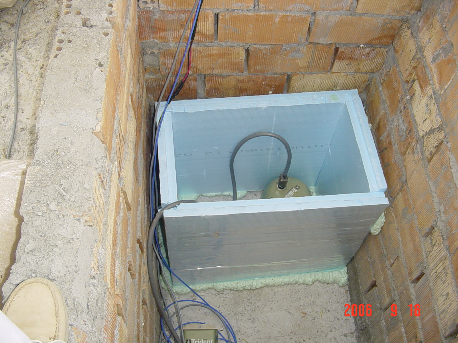
Network description -remote stations PSLNET’s first deployed station was LTK (Fig.1), this was done in 2003 and since then the installation of new stations is carrying on. The majority of PSLNET’s stations are equipped with Nanometrics Trillium (40s) sensors but other sensors exist also (see Fig.1). Two stations LTK and PYL are operated in cooperation with Charles University in Prague; these two are equipped with Guralp CMG-3T 120s sensors and strong motion accelerographs, CMG-5T, too. Real time data from LTK station are sent to ORFEUS. Acquisition at most stations is based on Nanometrics Trident 24bit digitizers and Libra VSAT telemetry system (Fig.2) that incorporates the TDMA (Time Domain Multiple Access) access protocol. Libra system provides an efficient solution for seismological data transmission. Five stations are equipped with Geotech Smart 24 digitizers and HellasSat satellite broadband internet. User has full control of the remote sites from the central recording site, allowing e.g. centering of the sensors and monitoring of state of health parameters. Remote sites are installed either in small houses or as underground vaults. Considerable effort has been put towards the construction of low noise, reliable stations by careful shielding of electronics and sensor against electrical and environmental disturbances. Special care has been taken for the temperature isolation of the sensors.
Figure 2. Libra VSAT telemetry system
Network description -central station Remote stations transmit data, (100Hz sampling rate, continuous records) to central Hub that is located in the University of Patras campus. This device is taking care of all data transmission by distributing the available bandwidth among remote stations, based on the TDMA protocol. The satellite system operates in Ku-band and currently the HellasSat satellite is in use. The performance of the telemetry system is very good and it efficiently balances cost with data retrieval. Similar to acquisition system, the user has full control on the telemetry system also, thus state of health monitoring and parameter change is quite easy. The central Hub receives data packets and then forwards them through local network to NAQS server acquisition software. This is an acquisition and data handling software package that performs the following tasks: data storage in ring buffer files, state of health data storage, waveform and state of health data real time display, data error handling and retransmission request, triggering of events and access to ring buffer data for clients like e.g. picking software. Ring buffer files store continuous data and are copied on backup disks once per day.
Network performance - common problems The network’s performance is constantly monitored. As soon as an error occurs the system sends email and SMS alerts to technical personnel. Monitoring is based on state of health data; on a daily basis plots of various parameters are created (data gaps, retransmissions, GPS status, seismometer mass status, voltage), and state of health data are stored in a MySQL database. So far the main problems with data retrieval are thunderstorms (that can cause retransmissions and in extreme cases data gaps), power failures at remote sites and local network problems. Overall the performance of the network is very good with minor problems and minor data gaps for a long period of time. Besides the technical parameters we also monitor the ambient noise levels at each station on a daily basis. The PQLX analysis software, by McNamara and Boaz 2005, is used for the noise level monitoring and plots are posted on Lab’s web page. State of health is monitored using " MSO: An Application Designed for the Monitoring of Seismological Station Operation".
Manual ProcessingThe Nanometrics Atlas software is used for manual data processing (Fig.3), this means phase picking, epicenter location and magnitude determination. Results are stored in a MySQL database and are accessible through the Internet. The Hypoinverse program is used by Atlas for the determination of epicenter and the calculation of event magnitude. Two types of magnitudes are used; the duration and local magnitude using the Eaton, 1992 formula, implemented in Hypoinverse. Moment tensor solutions are calculated in the case of an event with M>4.0, using the ISOLA-GUI code (Sokos and Zahradnik 2008). The location and moment tensor results of the manual analysis are posted immediately at the EMSC web page, while in case of strong events a small report is prepared also. Examples of these reports, include the Leonidio earthquake (08/01/06, Mw6.2) and the Andravida earthquake (08/06/08, Mw6.4).
Figure 3. Flow chart of PSLNET operation (data transmission, acquisition and management).
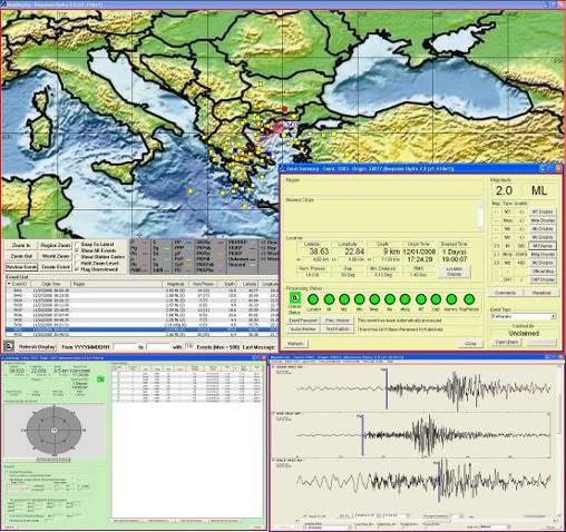
Automatic ProcessingFor the automatic detection and location of the seismic events the Hydra system is used (Fig.3,4). This is a state of the art automatic processing system that has been developed by USGS/NEIC. Hydra receives real time data from Naqs server and identifies, locates, and measures earthquakes. Thus, epicenter locations and seismic magnitudes (Ml, Mwp, mb, Ms etc) but also moment tensors are calculated automatically. Besides the automatic part, HYDRA is providing tools for manual analysis also. The user has full control on the final results by e.g. correcting phase picks, or excluding/adding stations and reevaluating the location. Moreover, Atlas software can interact with HYDRA and load data and automatic phase picks for manual processing. All solutions, automatic and manual ones are stored in a MySQL database and can be assessed using a Web interface.
Figure 4. Example of Hydra system display, location and phase picking windows are shown.
|